File:Folkestone Road, Dover - Geograph - 50553.jpg

From Roader's Digest: The SABRE Wiki
Jump to navigation Jump to search

Folkestone_Road,_Dover_-_Geograph_-_50553.jpg(640 × 429 pixels, file size: 293 KB, MIME type: image/jpeg)

Y topleft.gifY topright.gif
Description:Folkestone Road, Dover
Lined with B.& B's. I know, because I stayed in one of them. The Castle (not a B.& B.) is up on the hill, straight ahead.
Location:51.125537, 1.306568
Road:B2011
Date:4 1994
Photographer:� Copyright Ron Hann and licensed for reuse under this Creative Commons Licence
Source:Geograph

Map

Y btmleft.gifY btmright.gif

Galleries  | B2011 | Dover

File history

Click on a date/time to view the file as it appeared at that time.

Date/TimeThumbnailDimensionsUserComment
current13:20, 1 May 2011Thumbnail for version as of 13:20, 1 May 2011640 × 429 (293 KB)Si404 (talk | contribs)
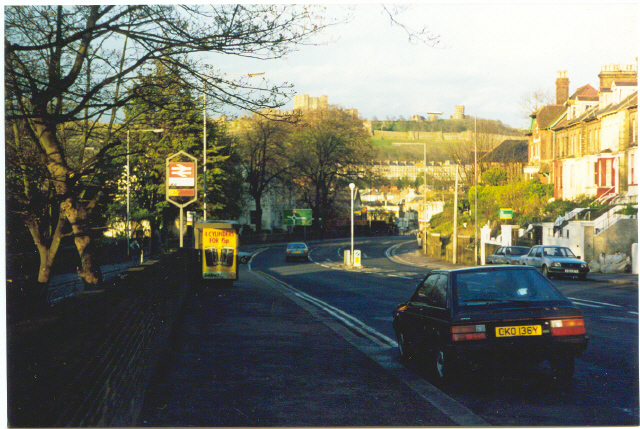
'''Folkestone Road, Dover'''<br/>Lined with B.& B's. I know, because I stayed in one of them. The Castle (not a B.& B.) is up on the hill, straight ahead.

There are no pages that use this file.

Metadata

SABRE - The Society for All British and Irish Road Enthusiasts
Discuss - Digest - Discover - Help