File:Former canal and road bridge - Geograph - 1574129.jpg

From Roader's Digest: The SABRE Wiki
Jump to navigation Jump to search

Former_canal_and_road_bridge_-_Geograph_-_1574129.jpg(640 × 427 pixels, file size: 104 KB, MIME type: image/jpeg)

Y topleft.gifY topright.gif
Description:
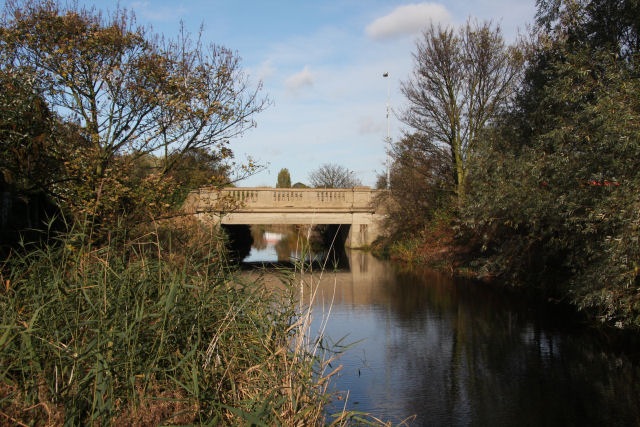
Former canal and road bridge
This section of canal was constructed in 1793 as part of the Stowmarket Navigation, linking Ipswich and Stowmarket via a series of fifteen locks. At this point it by-passes the River Gipping, but elsewhere the river itself becomes the 'Navigation'. It has not been used since the 1930s. The road bridge carries the Handford Road, one of the busiest sections of road in the town, which leads to the A12. A footpath follows the western side of the canal, linking Handford Road and West End Road.
Location:52.057638, 1.136459
Road:A1071, Handford Bridge
Date:04 11 2009
Photographer:� Copyright Bob Jones and licensed for reuse under this Creative Commons Licence
Source:Geograph

Map

Y btmleft.gifY btmright.gif

Galleries  | A1071 | Handford Bridge | S2

File history

Click on a date/time to view the file as it appeared at that time.

Date/TimeThumbnailDimensionsUserComment
current13:23, 14 June 2010Thumbnail for version as of 13:23, 14 June 2010640 × 427 (104 KB)Bob@romiley1 (talk | contribs)'''Former canal and road bridge'''<br/>This section of canal was constructed in 1793 as part of the Stowmarket Navigation, linking Ipswich and Stowmarket via a series of fifteen locks. At this point it by-passes the River Gipping, but elsewhere the river

The following 3 pages use this file:

Metadata

SABRE - The Society for All British and Irish Road Enthusiasts
Discuss - Digest - Discover - Help