File:Forster Bridge near Fordhouses, Wolverhampton - Geograph - 5204929.jpg
Jump to navigation
Jump to search

Size of this preview: 450 × 600 pixels. Other resolution: 480 × 640 pixels.
Original file (480 × 640 pixels, file size: 147 KB, MIME type: image/jpeg)
| |||||||||||||||||||||||||
|
Galleries | U119 (Wolverhampton) | Wolverhampton | Forster Bridge | ||
File history
Click on a date/time to view the file as it appeared at that time.
| Date/Time | Thumbnail | Dimensions | User | Comment | |
|---|---|---|---|---|---|
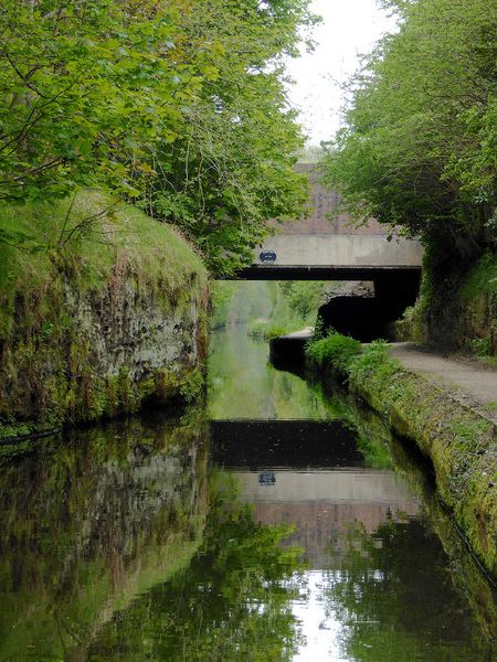
| current | 11:59, 28 March 2020 | | 480 × 640 (147 KB) | Steven (talk | contribs) | '''Forster Bridge near Fordhouses, Wolverhampton''' Staffordshire and Worcestershire Canal. Forster Bridge is No 68. The narrows are cut into the sandstone rock, and for a quarter of a mile or so narrowboats cannot pass each other. There are two wider spots in the narrows where one (maybe two) boat(s) can pass another coming the other way. The latest Nicholson Guide mentions that locally the stretch is called "Pendeford Rockin'", after a local farm. |
File usage
The following 3 pages use this file: