File:Fort Dunlop - Geograph - 3303533.jpg

From Roader's Digest: The SABRE Wiki
Jump to navigation Jump to search

Fort_Dunlop_-_Geograph_-_3303533.jpg(640 × 427 pixels, file size: 381 KB, MIME type: image/jpeg)

Y topleft.gifY topright.gif
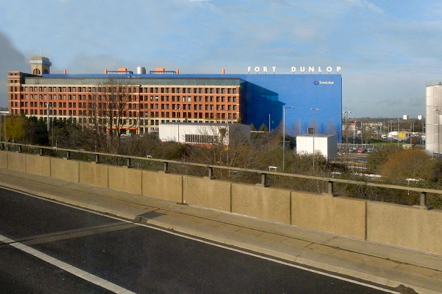
Description:Fort Dunlop The Fort Dunlop building is a notable landmark next to the M6 in the Erdington district of Birmingham.

The Fort Dunlop factory was built in 1916 as the original tyre factory and main office of Dunlop Rubber. At one time it was the world's largest factory, employing 3,200 workers. In the 1970s it was still the largest tyre factory outside the United States, however, the increased number of foreign cars imported into Britain led to a decline in demand and, when the company was sold in the 1980s, large-scale tyre production ceased at Fort Dunlop.

The development company Urban Splash acquired the building in 1999 and the building, derelict for twenty years (with the exterior used as advertising space), has been redeveloped into an office and retail space with an adjoining Travelodge hotel. Work on the redevelopment commenced in December 2004.

Fort Dunlop is a Grade A locally listed building.
Location:52.510082, -1.811506
Road:M6
Date:17 12 2012
Photographer:(c) Copyright David Dixon and licensed for reuse under this Creative Commons Licence
Source:Geograph

Map

Y btmleft.gifY btmright.gif

Galleries  | M6 | Birmingham

File history

Click on a date/time to view the file as it appeared at that time.

Date/TimeThumbnailDimensionsUserComment
current17:35, 11 June 2016Thumbnail for version as of 17:35, 11 June 2016640 × 427 (381 KB)C2r (talk | contribs)'''Fort Dunlop''' The Fort Dunlop building is a notable landmark next to the M6 in the Erdington district of Birmingham. The Fort Dunlop factory was built in 1916 as the original tyre factory and main office of Dunlop Rubber. At one time it was the wo...

The following page uses this file:

Metadata

SABRE - The Society for All British and Irish Road Enthusiasts
Discuss - Digest - Discover - Help