File:Foundry Street (C) Paul McIlroy - Geograph - 402283.jpg

From Roader's Digest: The SABRE Wiki
Jump to navigation Jump to search

Foundry_Street_(C)_Paul_McIlroy_-_Geograph_-_402283.jpg(640 × 391 pixels, file size: 79 KB, MIME type: image/jpeg)

Y topleft.gifY topright.gif
Description:
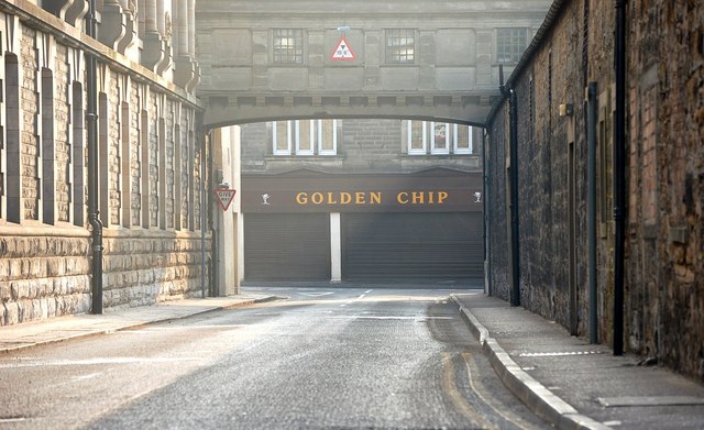
Foundry Street (C) Paul McIlroy
This is Foundry Street which separates St Margaret's Works and Pilmuir Works, but they are joined by the bridge in the top of the picture. The view is towards the chip shop in Pilmuir Street.
Location:56.074893, -3.461585
Road:A976
Date:15 04 2007
Photographer:Paul McIlroy and licensed for reuse under this Creative Commons Licence
Source:Geograph

Map

Y btmleft.gifY btmright.gif

Galleries  | A976 | Dunfermline

File history

Click on a date/time to view the file as it appeared at that time.

Date/TimeThumbnailDimensionsUserComment
current20:18, 2 May 2014Thumbnail for version as of 20:18, 2 May 2014640 × 391 (79 KB)Vlad (talk | contribs)'''Foundry Street (C) Paul McIlroy '''<br/>This is Foundry Street which separates St Margaret's Works and Pilmuir Works, but they are joined by the bridge in the top of the picture. The view is towards the chip shop in Pilmuir Street.

The following 3 pages use this file:

Metadata

SABRE - The Society for All British and Irish Road Enthusiasts
Discuss - Digest - Discover - Help