File:Geograph-3305443-by-Jaggery.jpg

From Roader's Digest: The SABRE Wiki
Jump to navigation Jump to search

Geograph-3305443-by-Jaggery.jpg(640 × 468 pixels, file size: 77 KB, MIME type: image/jpeg)

Y topleft.gifY topright.gif
Description:
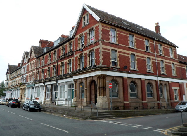
Grade II listed part of Gloucester Road, Avonmouth, Bristol
This whole line of buildings along Gloucester Road, from the corner of Meadow Street near the camera, past the three cars on the left, to the corner of Clayton Street, is Grade II listed. The listing includes the Royal Hotel Link at the left edge of the view.
The buildings, dating from c1870, were Grade II listed in March 1977.
Location:51.500225, -2.700149
Road:B3127 (Avonmouth)
Date:23 06 2012
Photographer:Jaggery and licensed for reuse under this Creative Commons Licence
Source:Geograph

Map

Y btmleft.gifY btmright.gif

Galleries  | B3127 (Avonmouth) | unclassified | Avonmouth

File history

Click on a date/time to view the file as it appeared at that time.

Date/TimeThumbnailDimensionsUserComment
current20:46, 21 November 2015Thumbnail for version as of 20:46, 21 November 2015640 × 468 (77 KB)Vlad (talk | contribs)'''Grade II listed part of Gloucester Road, Avonmouth, Bristol'''<br/>This whole line of buildings along Gloucester Road, from the corner of Meadow Street near the camera, past the three cars on the left, to the corner of Clayton Street, is Grade II li...

The following page uses this file:

SABRE - The Society for All British and Irish Road Enthusiasts
Discuss - Digest - Discover - Help