File:Gloucester a4150.jpg
Jump to navigation
Jump to search

Size of this preview: 800 × 562 pixels. Other resolution: 995 × 699 pixels.
Original file (995 × 699 pixels, file size: 398 KB, MIME type: image/jpeg)
| ||||||||||||||
|
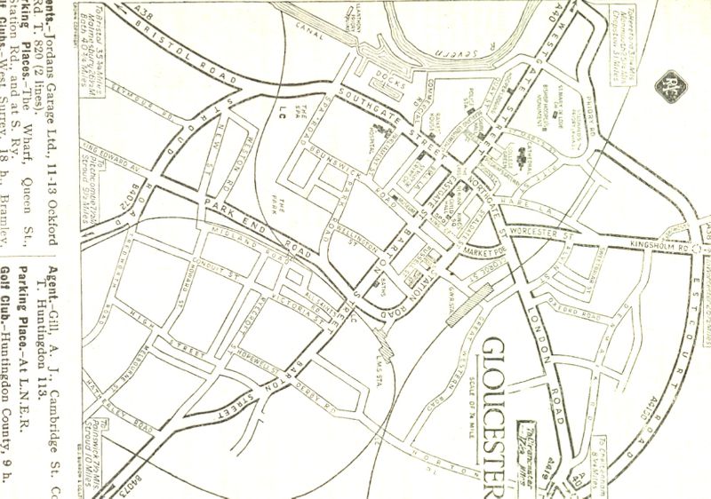
Galleries | A4150 (Gloucester) | Other Mapping | ||
File history
Click on a date/time to view the file as it appeared at that time.
| Date/Time | Thumbnail | Dimensions | User | Comment | |
|---|---|---|---|---|---|
| current | 19:30, 9 February 2013 | | 995 × 699 (398 KB) | Jonathanhaig (talk | contribs) | A4150 Estcourt Road, Gloucester 1936 RAC Handbook, a different location to the 1939 OS map on SABRE maps (Westgate Street). |
File usage
The following page uses this file: