File:Greyhound Bridge, Lancaster - Geograph - 652095.jpg
Jump to navigation
Jump to search

No higher resolution available.
Greyhound_Bridge,_Lancaster_-_Geograph_-_652095.jpg (640 × 470 pixels, file size: 48 KB, MIME type: image/jpeg)
| |||||||||||||||||||||||||
|
Galleries | A683 | A589 | Greyhound Bridge | ||
File history
Click on a date/time to view the file as it appeared at that time.
| Date/Time | Thumbnail | Dimensions | User | Comment | |
|---|---|---|---|---|---|
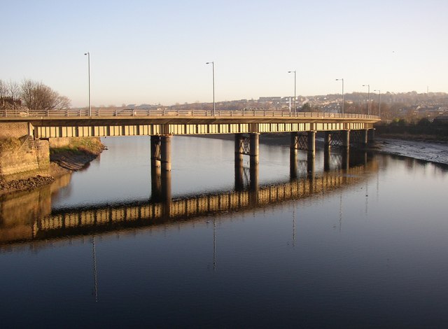
| current | 10:21, 2 August 2010 | | 640 × 470 (48 KB) | Bob@romiley1 (talk | contribs) | '''Greyhound Bridge, Lancaster'''<br/>This is now a road bridge, opened in 1972, but was built in 1911 as a railway bridge. It is curved in plan, and is supported by round iron piers. The first (wooden) railway bridge was completed in 1848, and replaced b |
File usage
The following 3 pages use this file: