File:Hagley-1924.jpg

From Roader's Digest: The SABRE Wiki
Jump to navigation Jump to search

Hagley-1924.jpg(367 × 277 pixels, file size: 86 KB, MIME type: image/jpeg)

Y topleft.gifY topright.gif
Description:Hagley, Worcestershire, 1924 This page contains scans from a map that is believed may be out of copyright according to UK Crown Copyright, UK Copyright Law for other maps published in the United Kingdom, or Irish Government Copyright, is not being used to generate profit in this context, and presents information that cannot be exhibited otherwise.
If the copyright holder considers this is an infringement of their rights, please contact the site management team to discuss further steps.
Location:This picture currently has no coords, edit this page to add them.
Road:A4032 (Hagley), B4187
Date:
Photographer:Steven
Source:Ordnance Survey MoT Road Map sheet 22, 1924-25 edition
Y btmleft.gifY btmright.gif

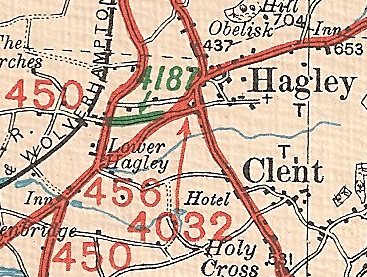
Galleries  | A4032 (Hagley) | B4187 | OS Ministry of Transport Road Map


File history

Click on a date/time to view the file as it appeared at that time.

Date/TimeThumbnailDimensionsUserComment
current22:57, 8 December 2010Thumbnail for version as of 22:57, 8 December 2010367 × 277 (86 KB)Steven (talk | contribs)Hagley, [[Worcestershire (County)|Worcestershire), 1924

The following 4 pages use this file:

Metadata

SABRE - The Society for All British and Irish Road Enthusiasts
Discuss - Digest - Discover - Help