File:Hammerhill Bridge, over the River Ouse,... (C) Pete Chapman - Geograph - 69962.jpg

From Roader's Digest: The SABRE Wiki
Jump to navigation Jump to search

Hammerhill_Bridge,_over_the_River_Ouse,..._(C)_Pete_Chapman_-_Geograph_-_69962.jpg(640 × 548 pixels, file size: 200 KB, MIME type: image/jpeg)

Y topleft.gifY topright.gif
Description:
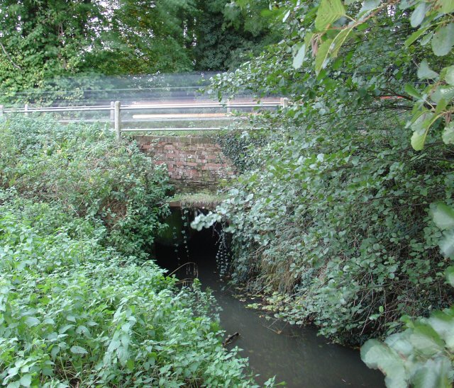
Hammerhill Bridge, over the River Ouse,... (C) Pete Chapman
On the higher (northern) stretch of the Sussex River Ouse (which flows through Lewes and joins the sea at the port of Newhaven). The B2114 between Staplefield and Cuckfield crosses over the bridge. The bridge itself is barely noticeable to the traffic which speeds across it (as shown in the picture!). View taken of the W (upstream) side of the bridge.
Location:51.031697, -0.174543
Road:B2114
Date:21 10 2005
Photographer:Pete Chapman and licensed for reuse under this Creative Commons Licence
Source:Geograph

Map

Y btmleft.gifY btmright.gif

Galleries  | B2114 | Hammerhill Bridge

File history

Click on a date/time to view the file as it appeared at that time.

Date/TimeThumbnailDimensionsUserComment
current13:35, 29 October 2014Thumbnail for version as of 13:35, 29 October 2014640 × 548 (200 KB)Jeni (talk | contribs)'''Hammerhill Bridge, over the River Ouse,... (C) Pete Chapman '''<br/>On the higher (northern) stretch of the Sussex River Ouse (which flows through Lewes and joins the sea at the port of Newhaven). The B2114 between Staplefield and Cuckfield crosses ...

The following 3 pages use this file:

Metadata

SABRE - The Society for All British and Irish Road Enthusiasts
Discuss - Digest - Discover - Help