File:Haslingden Road 010.jpg
Jump to navigation
Jump to search

No higher resolution available.
Haslingden_Road_010.jpg (640 × 430 pixels, file size: 71 KB, MIME type: image/jpeg)
| |||||||||||||||||||||||||
|
Galleries | B6232 | A6077 | A6177 (Blackburn - Haslingden) | Blackburn | ||
File history
Click on a date/time to view the file as it appeared at that time.
| Date/Time | Thumbnail | Dimensions | User | Comment | |
|---|---|---|---|---|---|
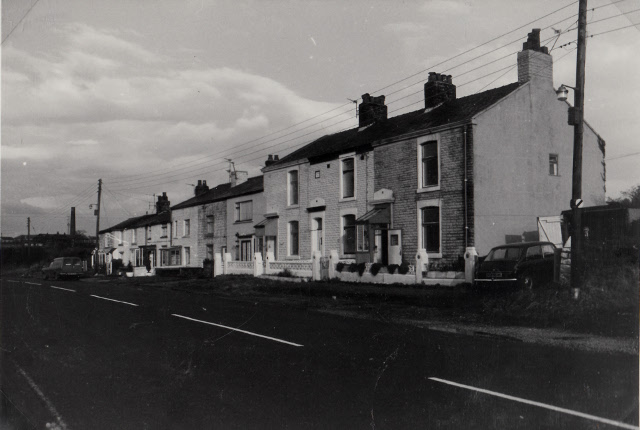
| current | 12:33, 12 December 2016 | | 640 × 430 (71 KB) | Bryn666 (talk | contribs) | Haslingden Road in 1979, as the B6232 and with National Speed Limit. The houses remain but all the surrounding fields have all been developed since. The road is now 30 mph. |
File usage
The following 3 pages use this file: