File:Heritage Plaque - Geograph - 2185415.jpg
Jump to navigation
Jump to search

No higher resolution available.
Heritage_Plaque_-_Geograph_-_2185415.jpg (640 × 480 pixels, file size: 107 KB, MIME type: image/jpeg)
| |||||||||||||||||||||||||
|
Galleries | A127 | Rayleigh Weir Interchange | ||
File history
Click on a date/time to view the file as it appeared at that time.
| Date/Time | Thumbnail | Dimensions | User | Comment | |
|---|---|---|---|---|---|
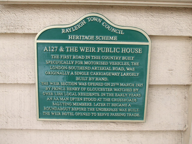
| current | 05:53, 7 August 2016 | | 640 × 480 (107 KB) | C2r (talk | contribs) | '''Heritage Plaque''' This plaque has been placed on the wall of the Weir Public House by Rayleigh Town Council to celebrate the opening of the A127 Arterial Road in 1925. |
File usage
The following 2 pages use this file: