File:Hockley Viaduct- planned route of NCN 23 (C) Caroline Maynard - Geograph - 2768734.jpg
Jump to navigation
Jump to search

Size of this preview: 600 × 600 pixels. Other resolution: 640 × 640 pixels.
Original file (640 × 640 pixels, file size: 126 KB, MIME type: image/jpeg)
| |||||||||||||||||||||||||
|
Galleries | NCN23 | Winchester | ||
File history
Click on a date/time to view the file as it appeared at that time.
| Date/Time | Thumbnail | Dimensions | User | Comment | |
|---|---|---|---|---|---|
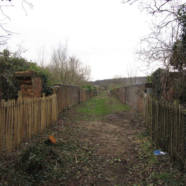
| current | 12:36, 8 March 2014 | | 640 × 640 (126 KB) | Si404 (talk | contribs) | '''Hockley Viaduct- planned route of NCN 23 (C) Caroline Maynard '''<br/>The Hockley Viaduct, which once carried the Southampton to Newbury railway across the Winchester Water Meadows. In the 1980s the local council planned to engage the army to blow u... |
File usage
The following 2 pages use this file:
_Caroline_Maynard_-_Geograph_-_2768734.jpg&oldid=366390)