File:Hooley Interchange planed.png
Jump to navigation
Jump to search

No higher resolution available.
Hooley_Interchange_planed.png (258 × 237 pixels, file size: 10 KB, MIME type: image/png)
File history
Click on a date/time to view the file as it appeared at that time.
| Date/Time | Thumbnail | Dimensions | User | Comment | |
|---|---|---|---|---|---|
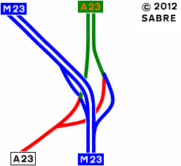
| current | 17:06, 26 June 2012 | | 258 × 237 (10 KB) | Abeaton (talk | contribs) | Now added Northbound on-slip |
| 09:03, 12 March 2010 |  | 258 × 237 (9 KB) | Abeaton (talk | contribs) | New version. | |
| 09:01, 12 March 2010 |  | 258 × 237 (9 KB) | Abeaton (talk | contribs) | This was the planed layout of the Hooley Interchange |
File usage
The following page uses this file: