File:I54 wobaston road.jpg
Jump to navigation
Jump to search

No higher resolution available.
I54_wobaston_road.jpg (212 × 150 pixels, file size: 12 KB, MIME type: image/jpeg)
| |||||||||||||||||||||||||
|
Galleries | A449 | Vine Island Junction | Wolverhampton | ||
File history
Click on a date/time to view the file as it appeared at that time.
| Date/Time | Thumbnail | Dimensions | User | Comment | |
|---|---|---|---|---|---|
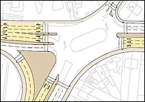
| current | 19:20, 20 October 2011 | | 212 × 150 (12 KB) | Steven (talk | contribs) | 2010 proposals for improvement to Vine Island Junction, Wolverhampton |
File usage
The following page uses this file: