File:Img118.jpg
Jump to navigation
Jump to search

No higher resolution available.
Img118.jpg (635 × 414 pixels, file size: 38 KB, MIME type: image/jpeg)
| |||||||||||||||||||||||||
|
Galleries | A9 | B970 | A951 (Aviemore) | A9/history | A9/route | Aviemore | Other Mapping | ||
File history
Click on a date/time to view the file as it appeared at that time.
| Date/Time | Thumbnail | Dimensions | User | Comment | |
|---|---|---|---|---|---|
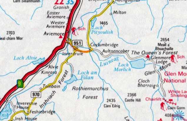
| current | 18:39, 18 March 2012 | | 635 × 414 (38 KB) | Halmyre (talk | contribs) | Map, c.1977, of the road network in the vicinity of Aviemore. |
| 18:30, 18 March 2012 |  | 698 × 455 (49 KB) | Halmyre (talk | contribs) | Map, c.1977, showing the A9, A970 and B951 around Aviemore. |
File usage
The following page uses this file: