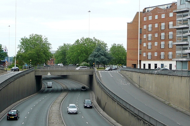
Inner Distribution Road This is Reading's inner ring road, the IDR as it is usually known. It was built in 1970 and many houses were demolished to create it, as was the planning norm then. There have been various plans to break what is now a collar throttling the expansion of Reading town centre. To the left is the Chatham Place development, and one plan was to deck over this section to create an urban square, but the slip roads would have caused a problems. Another plan was to make the route one-way, giving extra space for cycles and pedestrians, but this has also been abandoned. To the right is Adelphi House, the Reading job centre. Mentioning this probably means I shall be emailed with lots of questions about employment now!
'''Inner Distribution Road'''<br/>This is Reading's inner ring road, the IDR as it is usually known. It was built in 1970 and many houses were demolished to create it, as was the planning norm then. There have been various plans to break what is now a c
File usage
There are no pages that use this file.
Metadata
This file contains additional information, probably added from the digital camera or scanner used to create or digitise it.
If the file has been modified from its original state, some details may not fully reflect the modified file.
