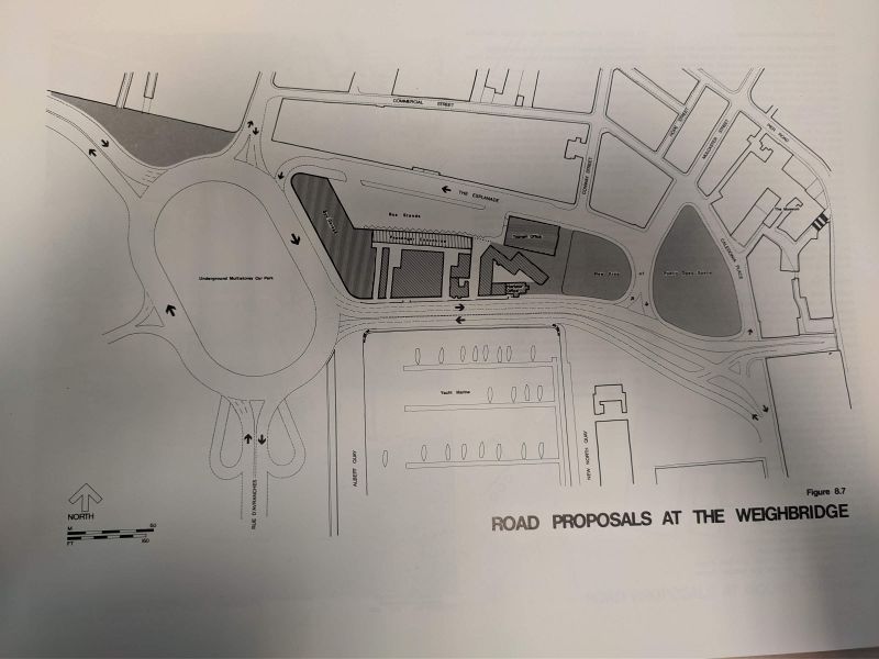
Jersey Island Plan 1986 showing proposals for the new roads and bus station in the reclamation. The proposals included keeping the Esplanade to its original alignment and constructing a new mega roundabout with an underground multistorey car park in the centre. The Esplanade east of Castle Street would be one-way to serve the new bus station, located at the old abattoir, with the A1 travelling along its modern aligment towards the Tunnel.
In the end, a new relief road and grade separated roundabout was constructed. The underground car park was constructed a bit further south and a surface car park was built between the relief road and the old A1.
Jersey Island Plan 1986 showing proposals for the new roads and bus station in the reclamation. The proposals included keeping the Esplanade to its original alignment and constructing a new mega roundabout with an underground multistorey car park in the centre. The Esplanade east of Castle Street would be one-way to serve the new bus station, located at the old abattoir, with the A1 travelling along its modern aligment towards the Tunnel. In the end, a new relief road and grade separated rou...
