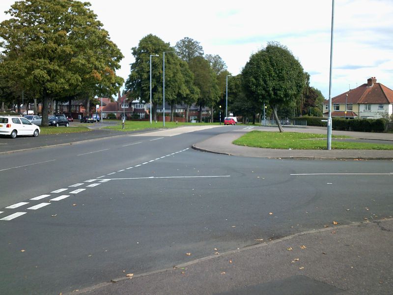
A junction between the B4514 and Dolphin Lane. This continues the B4514's tradition of being confusing for drivers, although in a different way from its usual style about confusion about which way roads run. It's a staggered junction (Dolphin Lane entering from the bottom right, and continuing to the top left), except it's also a crossroads (the road in the top right continues opposite Dolphin Lane, but is Wildfell Road), making this a variant of the TOTSO. Additionally, it looks a lot like there's a splitter island on the right, but there isn't; in the centre right of the diagram is actually a cul-de-sac spur of Dolphin Lane. The 'other carriageway' of the B4514 is barely visible in the centre left, and has been converted into a driveway.
A junction between the B4514 and Dolphin Lane. This continues the B4514's tradition of being confusing for drivers, although in a different way from its usual style about confusion about which way roads run. It's a staggered junction (Dolphin L...
File usage
There are no pages that use this file.
Metadata
This file contains additional information, probably added from the digital camera or scanner used to create or digitise it.
If the file has been modified from its original state, some details may not fully reflect the modified file.
