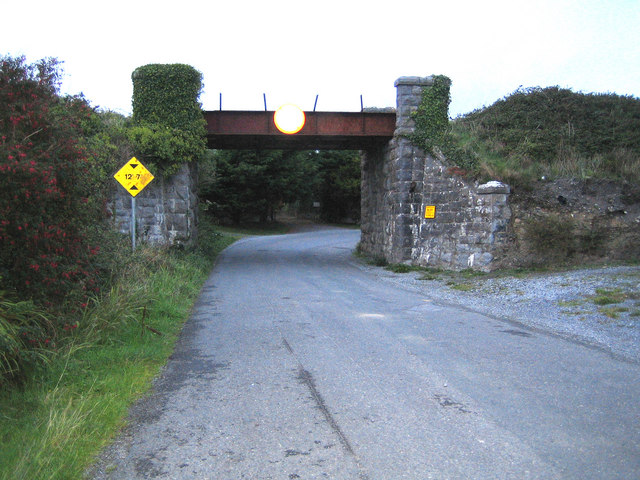
Kilfenora railway bridge The bridge carried the now defunct former Great Southern and Western Railway line from Tralee to Fenit over the road.
One of the features shown on the Ordnance Survey of Ireland 1:50,000 scale maps, that does not appear on the British equivalent, is bridge clearance heights. Here the sign board states 12 feet 7 inches which agrees exactly with the 3.84 metres on the map.
'''Kilfenora railway bridge''' The bridge carried the now defunct former Great Southern and Western Railway line from Tralee to Fenit over the road. One of the features shown on the Ordnance Survey of Ireland 1:50,000 scale maps, that does not appear ...
File usage
There are no pages that use this file.
Metadata
This file contains additional information, probably added from the digital camera or scanner used to create or digitise it.
If the file has been modified from its original state, some details may not fully reflect the modified file.
