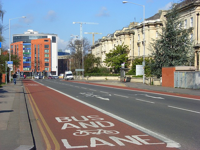
King's Road, Reading The bus lane makes for a speedy passage into the town centre for public transport users whilst private vehicles queue on London Road. The viewpoint is opposite the college. The colourful apartments are at the junction with Queen's Road.
'''King's Road, Reading'''<br/>The bus lane makes for a speedy passage into the town centre for public transport users whilst private vehicles queue on London Road. The viewpoint is opposite the college. The colourful apartments are at the junction with Q
File usage
There are no pages that use this file.
Metadata
This file contains additional information, probably added from the digital camera or scanner used to create or digitise it.
If the file has been modified from its original state, some details may not fully reflect the modified file.
