File:Kingstown Interchange 2012.png&-8206;.png
Jump to navigation
Jump to search

No higher resolution available.
Kingstown_Interchange_2012.png&-8206;.png (258 × 237 pixels, file size: 11 KB, MIME type: image/png)
| |||||||||||||||||||||||||
|
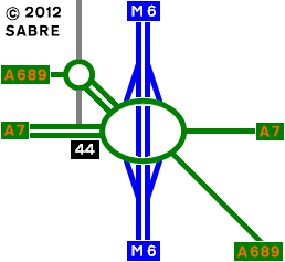
Galleries | M6 | A7 | A689 | Kingstown Interchange | Strip Maps | ||
File history
Click on a date/time to view the file as it appeared at that time.
| Date/Time | Thumbnail | Dimensions | User | Comment | |
|---|---|---|---|---|---|
| current | 16:02, 28 April 2012 | | 258 × 237 (11 KB) | Abeaton (talk | contribs) | kingstown Interchange as it is now. |
File usage
The following 3 pages use this file: