File:Knot Hill - Geograph - 605942.jpg

From Roader's Digest: The SABRE Wiki
Jump to navigation Jump to search

Knot_Hill_-_Geograph_-_605942.jpg(640 × 442 pixels, file size: 65 KB, MIME type: image/jpeg)

Y topleft.gifY topright.gif
Description:
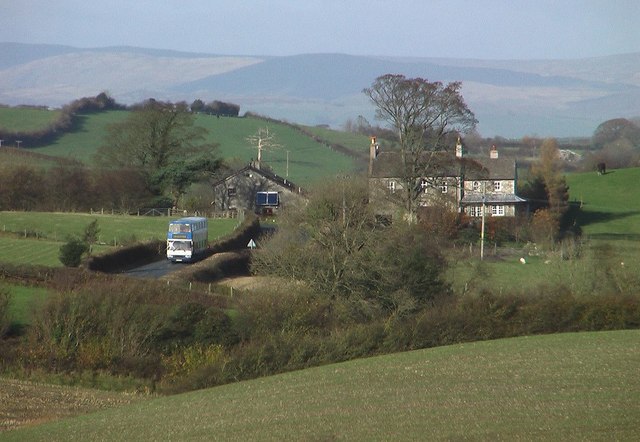
Knot Hill
The bus travelling along the B6384 is on the 555 service from Keswick to Lancaster which must be one of the longest rural bus routes, taking two and a half hours to travel the length of the Lake District.
Location:54.217886, -2.750485
Road:b6384
Date:06 11 2007
Photographer:� Copyright Don Burgess and licensed for reuse under this Creative Commons Licence
Source:Geograph

Map

Y btmleft.gifY btmright.gif

Galleries  | b6384 | S2

File history

Click on a date/time to view the file as it appeared at that time.

Date/TimeThumbnailDimensionsUserComment
current12:36, 11 April 2010Thumbnail for version as of 12:36, 11 April 2010640 × 442 (65 KB)Bob@romiley1 (talk | contribs)'''Knot Hill'''<br/>The bus travelling along the B6384 is on the 555 service from Keswick to Lancaster which must be one of the longest rural bus routes, taking two and a half hours to travel the length of the Lake District.

The following 2 pages use this file:

Metadata

SABRE - The Society for All British and Irish Road Enthusiasts
Discuss - Digest - Discover - Help