File:Knowlbank Interchange approved design.png
Jump to navigation
Jump to search

No higher resolution available.
Knowlbank_Interchange_approved_design.png (720 × 370 pixels, file size: 57 KB, MIME type: image/png)
| |||||||||||||||||||||||||
|
Galleries | M54 | A464 | Castle Farm Interchange | Telford | ||
File history
Click on a date/time to view the file as it appeared at that time.
| Date/Time | Thumbnail | Dimensions | User | Comment | |
|---|---|---|---|---|---|
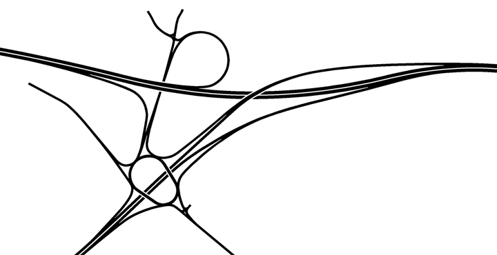
| current | 23:55, 31 January 2017 | | 720 × 370 (57 KB) | Truvelo (talk | contribs) | Layout of Castle Farm Interchange, then known as Knowlsbank Interchange, as approved in 1973. This layout was to allow freeflow access between the M54 and the new town of Telford. Plans for Telford were soon scaled back so the design was ch... |
File usage
The following 4 pages use this file: