File:Landslip at Mam Tor - Geograph - 267618.jpg
Jump to navigation
Jump to search

Size of this preview: 450 × 600 pixels. Other resolution: 480 × 640 pixels.
Original file (480 × 640 pixels, file size: 80 KB, MIME type: image/jpeg)
| |||||||||||||||||||||||||
|
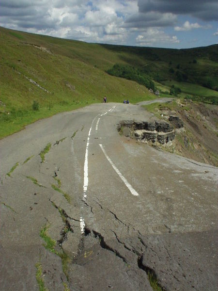
Galleries | A625 | S2 | Abandoned Road | ||
File history
Click on a date/time to view the file as it appeared at that time.
| Date/Time | Thumbnail | Dimensions | User | Comment | |
|---|---|---|---|---|---|
| current | 22:37, 11 April 2010 | | 480 × 640 (80 KB) | Ravenbluemoon (talk | contribs) | Landslip on the old A625 at Mam Tor |
File usage
The following 2 pages use this file: