File:Last day of the old Renfrew ferry - Geograph - 531786.jpg
Jump to navigation
Jump to search

No higher resolution available.
Last_day_of_the_old_Renfrew_ferry_-_Geograph_-_531786.jpg (640 × 439 pixels, file size: 56 KB, MIME type: image/jpeg)
| |||||||||||||||||||||||||
|
Galleries | A741 | Renfrew-Yoker Ferry | ||
File history
Click on a date/time to view the file as it appeared at that time.
| Date/Time | Thumbnail | Dimensions | User | Comment | |
|---|---|---|---|---|---|
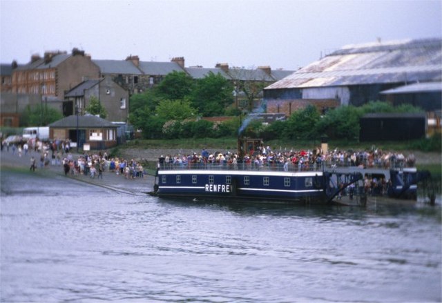
| current | 22:57, 11 March 2021 | | 640 × 439 (56 KB) | Tam nugent (talk | contribs) | Last day's service of the old chain-operated Renfrew ferry. The W is not actually missing from the white-painted RENFREW on the side, just covered by dirt. Pity they didn't clean it up for its last journey. |
File usage
There are no pages that use this file.