File:Lix Toll - Geograph - 62908.jpg

From Roader's Digest: The SABRE Wiki
Jump to navigation Jump to search

Lix_Toll_-_Geograph_-_62908.jpg(640 × 480 pixels, file size: 150 KB, MIME type: image/jpeg)

Y topleft.gifY topright.gif
Description:
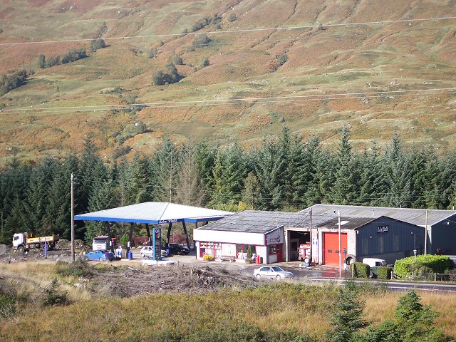
Lix Toll
This garage is a landmark on a remote stretch of the !A85 trunk road where it turns west to follow Glen Dochart towards Crianlarich after running northwards through Glen Ogle. There are often several recovery vehicles parked alongside. This photo was taken from a vantage point on the dismantled railway just to the south.
Location:56.441497, -4.360075
Road:A85/Glen Ogle, A827 , Lix Toll
Date:08 10 2005
Photographer:� Copyright Lis Burke and licensed for reuse under this Creative Commons Licence
Source:Geograph

Map

Y btmleft.gifY btmright.gif

Galleries  | A85/Glen Ogle | A827 | Lix Toll | Petrol station

File history

Click on a date/time to view the file as it appeared at that time.

Date/TimeThumbnailDimensionsUserComment
current14:45, 29 October 2010Thumbnail for version as of 14:45, 29 October 2010640 × 480 (150 KB)Rileyrob (talk | contribs)'''Lix Toll'''<br/>This garage is a landmark on a remote stretch of the !A85 trunk road where it turns west to follow Glen Dochart towards Crianlarich after running northwards through Glen Ogle. There are often several recovery vehicles parked alongside.

The following 2 pages use this file:

Metadata

SABRE - The Society for All British and Irish Road Enthusiasts
Discuss - Digest - Discover - Help