File:Llangadog level crossing (C) Jaggery - Geograph - 3315081.jpg
Jump to navigation
Jump to search

No higher resolution available.
Llangadog_level_crossing_(C)_Jaggery_-_Geograph_-_3315081.jpg (640 × 422 pixels, file size: 70 KB, MIME type: image/jpeg)
| |||||||||||||||||||||||||
|
Galleries | A4069 | Level Crossing | Carmarthenshire | ||
File history
Click on a date/time to view the file as it appeared at that time.
| Date/Time | Thumbnail | Dimensions | User | Comment | |
|---|---|---|---|---|---|
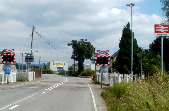
| current | 11:01, 3 November 2013 | | 640 × 422 (70 KB) | Glen (talk | contribs) | '''Llangadog level crossing (C) Jaggery '''<br/>The A4069 crosses the single-track Heart of Wales railway line. Llangadog railway station is to the right. |
File usage
The following 2 pages use this file:
_Jaggery_-_Geograph_-_3315081.jpg&oldid=376645)