File:Llantrisant Radial.png
Jump to navigation
Jump to search

Size of this preview: 800 × 247 pixels. Other resolution: 1,600 × 494 pixels.
Original file (1,600 × 494 pixels, file size: 155 KB, MIME type: image/png)
| |||||||||||||||||||||||||
|
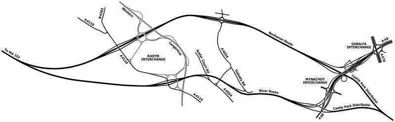
Galleries | A48(M) (Llantrisant Radial) | Western Tangential | Cardiff | ||
File history
Click on a date/time to view the file as it appeared at that time.
| Date/Time | Thumbnail | Dimensions | User | Comment | |
|---|---|---|---|---|---|
| current | 19:45, 22 August 2014 | 1,600 × 494 (155 KB) | Truvelo (talk | contribs) | Plan showing the two alternative routes for the Llantrisant Radial |
File usage
The following 2 pages use this file: