File:Longham Bridge & River Stour - Geograph - 1169713.jpg
Jump to navigation
Jump to search

No higher resolution available.
Longham_Bridge_&_River_Stour_-_Geograph_-_1169713.jpg (640 × 480 pixels, file size: 78 KB, MIME type: image/jpeg)
| |||||||||||||||||||||||||
|
Galleries | A348 | ||
File history
Click on a date/time to view the file as it appeared at that time.
| Date/Time | Thumbnail | Dimensions | User | Comment | |
|---|---|---|---|---|---|
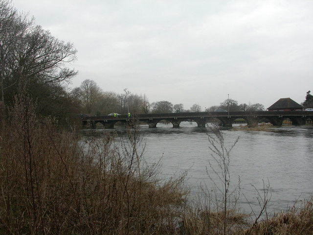
| current | 14:19, 10 May 2010 | | 640 × 480 (78 KB) | Bob@romiley1 (talk | contribs) | '''Longham Bridge & River Stour'''<br/>Longham Bridge was built in 1728, widened in 1792, and the cantilevered footpath added in about 1960. As seen from the river bank, looking upstream. Yellow coats belong to two surveyors. For a view of the bridge at r |
File usage
The following 2 pages use this file: