File:Loughor bridge - Geograph - 257475.jpg

From Roader's Digest: The SABRE Wiki
Jump to navigation Jump to search

Loughor_bridge_-_Geograph_-_257475.jpg(640 × 480 pixels, file size: 84 KB, MIME type: image/jpeg)

Y topleft.gifY topright.gif
Description:
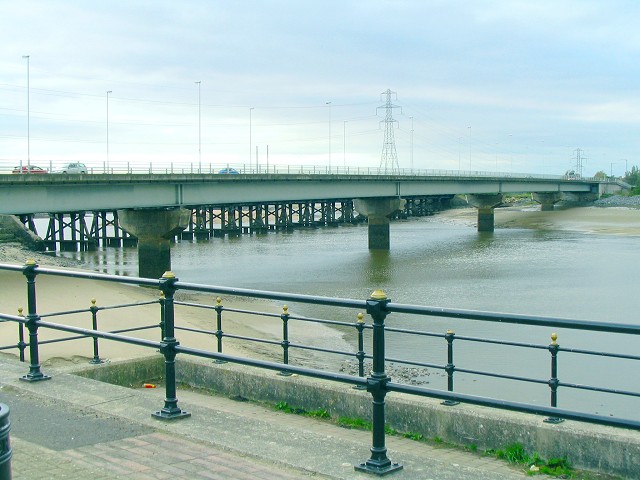
Loughor bridge
The road from Llanelli runs over the Loughor estuary towards Gorseinon. Just behind it the supports of the parallel rail bridge can be seen. This is the view from a view point on the east bank, upstream.
Location:51.663255, -4.079098
Road:A484
Date:10 10 2006
Photographer:� Copyright Nigel Davies and licensed for reuse under this Creative Commons Licence
Source:Geograph

Map

Y btmleft.gifY btmright.gif

Galleries  | A484 | Loughor Bridge

File history

Click on a date/time to view the file as it appeared at that time.

Date/TimeThumbnailDimensionsUserComment
current10:58, 12 August 2010Thumbnail for version as of 10:58, 12 August 2010640 × 480 (84 KB)Bob@romiley1 (talk | contribs)'''Loughor bridge'''<br/>The road from Llanelli runs over the Loughor estuary towards Gorseinon. Just behind it the supports of the parallel rail bridge can be seen. This is the view from a view point on the east bank, upstream.

The following 3 pages use this file:

Metadata

SABRE - The Society for All British and Irish Road Enthusiasts
Discuss - Digest - Discover - Help