No higher resolution available.
File history
Click on a date/time to view the file as it appeared at that time.
| Date/Time | Thumbnail | Dimensions | User | Comment |
|---|
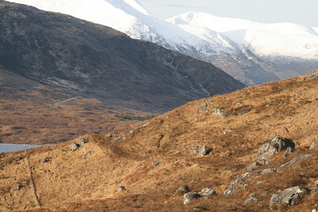
| current | 11:47, 8 February 2012 |  | 640 × 427 (166 KB) | Rileyrob (talk | contribs) | The old military road above Loch Cluanie becomes more visible ahead, but is still no easier to trace when you get there. |
File usage
There are no pages that use this file.
This file contains additional information, probably added from the digital camera or scanner used to create or digitise it.
If the file has been modified from its original state, some details may not fully reflect the modified file.
