File:Lyme-1946.jpg
Jump to navigation
Jump to search

No higher resolution available.
Lyme-1946.jpg (600 × 537 pixels, file size: 159 KB, MIME type: image/jpeg)
| |||||||||||||||||||||||||
|
Galleries | A35 | A373 | A3070 | A3052 | B3165 (Somerset) | OS One Inch | ||
File history
Click on a date/time to view the file as it appeared at that time.
| Date/Time | Thumbnail | Dimensions | User | Comment | |
|---|---|---|---|---|---|
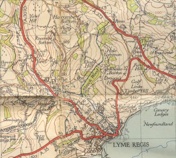
| current | 18:16, 27 November 2009 | | 600 × 537 (159 KB) | Rileyrob (talk | contribs) | {{Information |description = Lyme Regis in 1946, showing the A35 on its original southerly course and the A3070. |day = |month = |year = 1946 |photographer = |source = OS NPE Sheet 177 |road = A35 |road2 = |