File:M12 at Ballinacor, Portadown - Geograph - 527100.jpg

From Roader's Digest: The SABRE Wiki
Jump to navigation Jump to search

M12_at_Ballinacor,_Portadown_-_Geograph_-_527100.jpg(640 × 480 pixels, file size: 71 KB, MIME type: image/jpeg)

Y topleft.gifY topright.gif
Description:
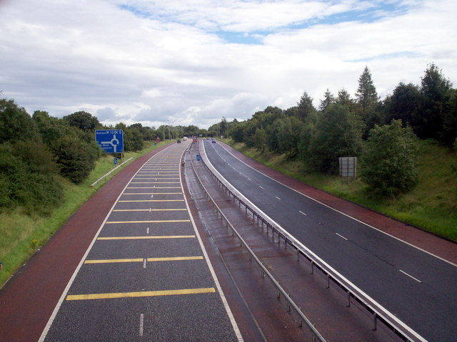
M12 at Ballinacor, Portadown
This photograph was taken from the Charlestown Road bridge looking northeast towards, possibly, the only 'roundabout' on a motorway in the British Isles. Note the Traffic Calming Strips to alert motorists to slow down for the roundabout ahead. The construction of this 'roundabout' saved the Government some 2-3 million pounds in alternative construction methods. Concern at such a construction on a motorway did result in some spectecular spills from large vehicles negotiationg the roundabout. Thankfully no one has been badly injured and re-adjustments to the camber of the road has proved successful so far.
Location:54.4603600, -6.4215946
Road:M12 (Northern Ireland), T5 (Northern Ireland) , E18
Date:16 08 2007
Photographer:� Copyright P Flannagan and licensed for reuse under this Creative Commons Licence
Source:Geograph

Map

Y btmleft.gifY btmright.gif

Galleries  | M12 (Northern Ireland) | T5 (Northern Ireland) | E18 | Ballynacor Interchange

File history

Click on a date/time to view the file as it appeared at that time.

Date/TimeThumbnailDimensionsUserComment
current10:57, 16 June 2010Thumbnail for version as of 10:57, 16 June 2010640 × 480 (71 KB)Si404 (talk | contribs)'''M12 at Ballinacor, Portadown'''<br/>This photograph was taken from the Charlestown Road bridge looking northeast towards, possibly, the only "roundabout" on a motorway in the British Isles. Note the Traffic Calming Strips to alert motorists to slow dow

Metadata

SABRE - The Society for All British and Irish Road Enthusiasts
Discuss - Digest - Discover - Help