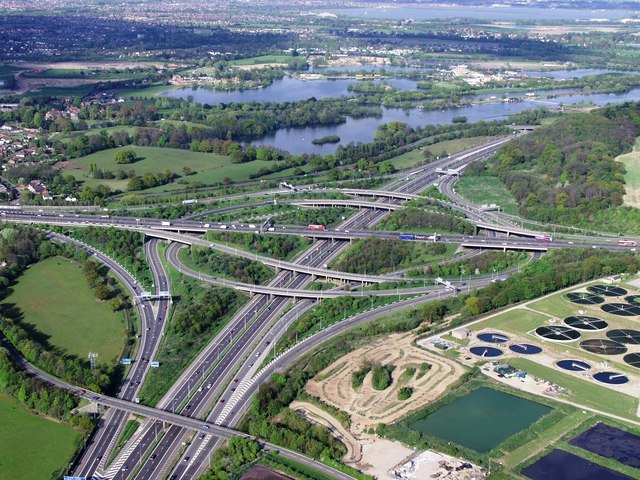
File:M25 junction 12 intersection with M3 - Geograph - 291771.jpg
Jump to navigation
Jump to search

No higher resolution available.
M25_junction_12_intersection_with_M3_-_Geograph_-_291771.jpg (640 × 480 pixels, file size: 121 KB, MIME type: image/jpeg)
| |||||||||||||||||||||||||
|
Galleries | M3 | M25 | Thorpe Interchange | Thorpe Park | ||
File history
Click on a date/time to view the file as it appeared at that time.
| Date/Time | Thumbnail | Dimensions | User | Comment | |
|---|---|---|---|---|---|
| current | 15:58, 23 May 2010 | | 640 × 480 (121 KB) | Si404 (talk | contribs) | Reverted to version as of 16:13, 8 September 2009 |
| 15:52, 23 May 2010 | No thumbnail | (19 KB) | Si404 (talk | contribs) | '''M25 junction 12 intersection with M3'''<br/>Aerial view looking towards Thorpe park in the distance | |
| 16:13, 8 September 2009 |  | 640 × 480 (121 KB) | Jeni (talk | contribs) | {{Information |description = M25 junction 12 intersection with M3 |day = 08 |month = 05 |year = 2001 |photographer = © Copyright [http://www.geograph.org.uk/profile/9052 RAY JONES] and licensed for reuse under [http://creativecom |
File usage
The following 3 pages use this file: