File:M2 FORTWILLIAM - Coppermine - 15970.jpg
Jump to navigation
Jump to search

Size of this preview: 800 × 464 pixels. Other resolution: 1,208 × 701 pixels.
Original file (1,208 × 701 pixels, file size: 180 KB, MIME type: image/jpeg)
| |||||||||||||||||||||||||
|
Galleries | M2 (Northern Ireland) | M5 (Northern Ireland) | Greencastle Interchange | Fortwilliam Roundabout | ||
File history
Click on a date/time to view the file as it appeared at that time.
| Date/Time | Thumbnail | Dimensions | User | Comment | |
|---|---|---|---|---|---|
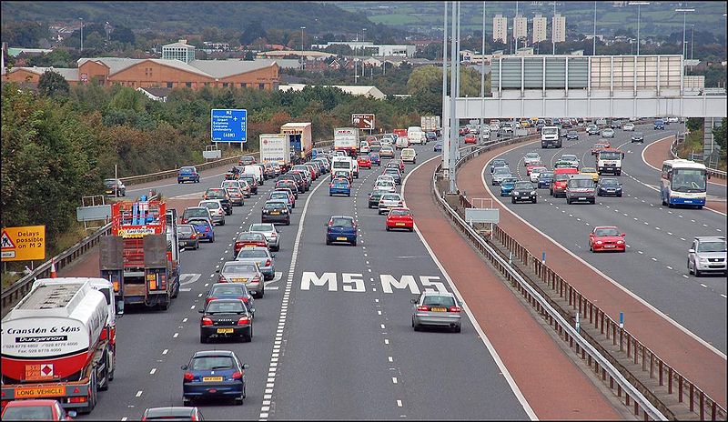
| current | 13:52, 17 March 2010 | | 1,208 × 701 (180 KB) | Jeni (talk | contribs) | '''M2 FORTWILLIAM''' The construction of an additional (southbound) lane from Sandyknowes to Greencastle and the closure of the northbound inside lane is having an effect on peak traffic flow. This queue is appx 2� miles long. Taken at 16.35 before the |
File usage
The following 3 pages use this file: