File:M3 Junction - Coppermine - 23437.jpg
Jump to navigation
Jump to search

Size of this preview: 800 × 599 pixels. Other resolution: 2,047 × 1,533 pixels.
Original file (2,047 × 1,533 pixels, file size: 523 KB, MIME type: image/jpeg)
| |||||||||||||||||||||||||
|
Galleries | R157 | Pace Interchange | ||
File history
Click on a date/time to view the file as it appeared at that time.
| Date/Time | Thumbnail | Dimensions | User | Comment | |
|---|---|---|---|---|---|
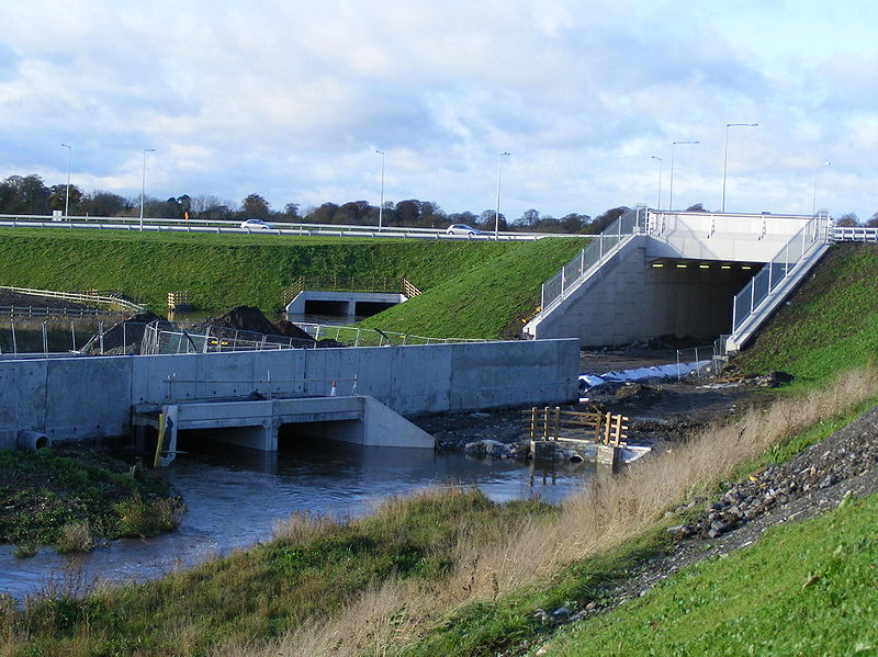
| current | 09:43, 12 June 2010 | | 2,047 × 1,533 (523 KB) | Bob@romiley1 (talk | contribs) | '''R157 Dunboyne Bypass/M3 Junction''' The Road is the incline of the R157 Dunboyne Bypass up to the M3 Pace Junction. The Underpass is for the future alignment of the Navan Rail line. The River is the Tolka and the Train park and ride is just to the lef |
File usage
The following 2 pages use this file: