File:M4 westbound slip roads, High Cross, Newport - Geograph - 2535377.jpg

From Roader's Digest: The SABRE Wiki
Jump to navigation Jump to search

M4_westbound_slip_roads,_High_Cross,_Newport_-_Geograph_-_2535377.jpg(640 × 480 pixels, file size: 86 KB, MIME type: image/jpeg)

Y topleft.gifY topright.gif
Description:
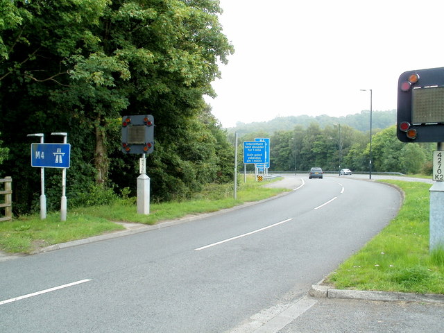
M4 westbound slip roads, High Cross, Newport Viewed from Glasllwch Crescent (B4591) at junction 27. The slip leads to, and the one on the right from, the westbound M4. The actual orientation of the motorway through the junction is NNE to SSW.
Location:51.585401, -3.033378
Road:M4
Date:21 07 2011
Photographer:(c) Copyright Jaggery and licensed for reuse under this Creative Commons Licence
Source:Geograph

Map

Y btmleft.gifY btmright.gif

Galleries  | M4 | Newport | High Cross Interchange

File history

Click on a date/time to view the file as it appeared at that time.

Date/TimeThumbnailDimensionsUserComment
current17:12, 8 June 2016Thumbnail for version as of 17:12, 8 June 2016640 × 480 (86 KB)Jeni (talk | contribs)'''M4 westbound slip roads, High Cross, Newport ''' Viewed from Glasllwch Crescent (B4591) at junction 27. The slip leads to, and the one on the right from, the westbound M4. The actual orientation of the motorway through the junction is NNE to SSW.

The following page uses this file:

SABRE - The Society for All British and Irish Road Enthusiasts
Discuss - Digest - Discover - Help