File:M67 jct Manchester Inner Ring Road freeflow design.png
Jump to navigation
Jump to search

No higher resolution available.
M67_jct_Manchester_Inner_Ring_Road_freeflow_design.png (360 × 430 pixels, file size: 37 KB, MIME type: image/png)
| |||||||||||||||||||||||||
|
Galleries | M67 | Manchester Inner Ring Road | Manchester | ||
File history
Click on a date/time to view the file as it appeared at that time.
| Date/Time | Thumbnail | Dimensions | User | Comment | |
|---|---|---|---|---|---|
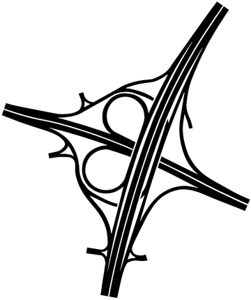
| current | 12:30, 18 December 2014 | | 360 × 430 (37 KB) | Truvelo (talk | contribs) | Freeflow design for the junction of M67 and Manchester Inner Ring Road as originally planned in the mid-1960s. The junction was later changed to a three level stacked roundabout before the entire project was scrapped in the 1970s. |
File usage
The following page uses this file: