File:M6 Original Haydock Island - Coppermine - 11393.jpg
Jump to navigation
Jump to search

No higher resolution available.
M6_Original_Haydock_Island_-_Coppermine_-_11393.jpg (600 × 378 pixels, file size: 47 KB, MIME type: image/jpeg)
| |||||||||||||||||||||||||
|
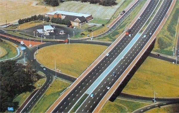
Galleries | M6 | A580 | Haydock Island | ||
File history
Click on a date/time to view the file as it appeared at that time.
| Date/Time | Thumbnail | Dimensions | User | Comment | |
|---|---|---|---|---|---|
| current | 18:08, 1 March 2010 | | 600 × 378 (47 KB) | Jeni (talk | contribs) | {{Information |description = '''M6 Original Haydock Island''' Aerial photo of Haydock Island (M6 J23) before the East Lancashire Road (A580) was pushed through the centre, If you look closely you can see the 'NO signs' on the northbound slip. The M6 is s |
File usage
The following 2 pages use this file: