File:Maybole from the Cemetery Brae - Geograph - 239174.jpg

From Roader's Digest: The SABRE Wiki
Jump to navigation Jump to search

Maybole_from_the_Cemetery_Brae_-_Geograph_-_239174.jpg(640 × 480 pixels, file size: 135 KB, MIME type: image/jpeg)

Y topleft.gifY topright.gif
Description:
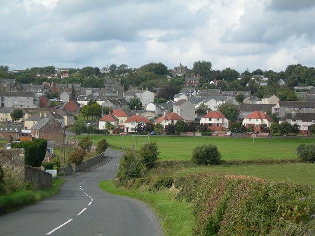
Maybole from the Cemetery Brae
SE edge of Maybole from the B7023, looking across The Glebe. This comprises the sports park and the rough, damp land in the foreground. The Glebe originally was a piece of land that belonged to the clergy.
Location:55.350199, -4.674885
Road:b7023
Date:13 09 2006
Photographer:� Copyright Mary and Angus Hogg and licensed for reuse under this Creative Commons Licence
Source:Geograph

Map

Y btmleft.gifY btmright.gif

Galleries  | b7023 | S2

File history

Click on a date/time to view the file as it appeared at that time.

Date/TimeThumbnailDimensionsUserComment
current16:53, 16 April 2010Thumbnail for version as of 16:53, 16 April 2010640 × 480 (135 KB)Bob@romiley1 (talk | contribs)'''Maybole from the Cemetery Brae'''<br/>SE edge of Maybole from the B7023, looking across The Glebe. This comprises the sports park and the rough, damp land in the foreground. The Glebe originally was a piece of land that belonged to the clergy.

The following page uses this file:

Metadata

SABRE - The Society for All British and Irish Road Enthusiasts
Discuss - Digest - Discover - Help