File:Mealt Waterfall - Geograph - 4681961.jpg

From Roader's Digest: The SABRE Wiki
Jump to navigation Jump to search

Mealt_Waterfall_-_Geograph_-_4681961.jpg(640 × 430 pixels, file size: 224 KB, MIME type: image/jpeg)

Y topleft.gifY topright.gif
Description:Mealt Waterfall The outflow burn from Loch Mealt seen dropping down its 60m waterfall to the sea. The causeway that divides the loch in two carries the A855 Portree to Staffin road. Beyond the loch are the cloud topped hills of the Trotternish Ridge.
Location:57.610735, -6.172698
Road:A855
Date:01 10 2015
Photographer:(c) Copyright John Allan and licensed for reuse under this Creative Commons Licence
Source:Geograph

Map

Y btmleft.gifY btmright.gif

Galleries  | A855 | Loch Mealt Causeway

File history

Click on a date/time to view the file as it appeared at that time.

Date/TimeThumbnailDimensionsUserComment
current12:54, 14 April 2022Thumbnail for version as of 12:54, 14 April 2022640 × 430 (224 KB)Rileyrob (talk | contribs)
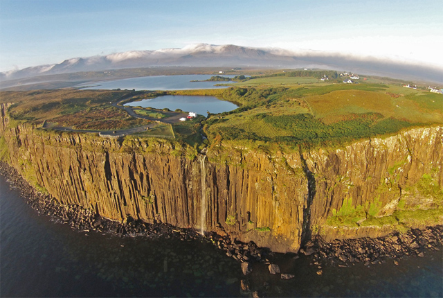
'''Mealt Waterfall''' The outflow burn from Loch Mealt seen dropping down its 60m waterfall to the sea. The causeway that divides the loch in two carries the A855 Portree to Staffin road. Beyond the loch are the cloud topped hills of the Trotternish Ridge.

The following 3 pages use this file:

Metadata

SABRE - The Society for All British and Irish Road Enthusiasts
Discuss - Digest - Discover - Help