File:Milepost in Sapcote - Geograph - 285764.jpg
Jump to navigation
Jump to search

Size of this preview: 450 × 600 pixels. Other resolution: 480 × 640 pixels.
Original file (480 × 640 pixels, file size: 96 KB, MIME type: image/jpeg)
| |||||||||||||||||||||||||
|
Galleries | B4669 | B579 (Hinckley) | A5070 (Hinckley) | S2 | ||
File history
Click on a date/time to view the file as it appeared at that time.
| Date/Time | Thumbnail | Dimensions | User | Comment | |
|---|---|---|---|---|---|
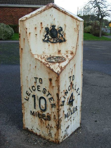
| current | 19:41, 19 March 2010 | | 480 × 640 (96 KB) | Bob@romiley1 (talk | contribs) | '''Milepost in Sapcote'''<br/>Standing prominently on the pavement close to the junction between Leicester Road (B4669) and Grace Road, to the east of the village centre, this milepost is need of some TLC. The post indicates distances to Leicester and Hin |
File usage
The following 3 pages use this file: