File:Moreton Spur extension plan 1967
Jump to navigation
Jump to search
No higher resolution available.
Moreton_Spur_extension_plan_1967 (557 × 495 pixels, file size: 65 KB, MIME type: image/jpeg)
| |||||||||||||||||||||||||
|
Galleries | A5027 | Moreton Spur | ||
File history
Click on a date/time to view the file as it appeared at that time.
| Date/Time | Thumbnail | Dimensions | User | Comment | |
|---|---|---|---|---|---|
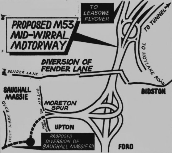
| current | 16:55, 19 February 2021 |  | 557 × 495 (65 KB) | Ross spur (talk | contribs) | A 1967 plan by Wallasey Council for a road extension from the M53 Moreton Spur to Saughall Massey Road |
File usage
The following page uses this file: