File:N71 road- In, er, County Cork - Geograph - 265670.jpg
Jump to navigation
Jump to search

No higher resolution available.
N71_road-_In,_er,_County_Cork_-_Geograph_-_265670.jpg (640 × 480 pixels, file size: 97 KB, MIME type: image/jpeg)
| |||||||||||||||||||||||||
|
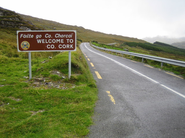
Galleries | N71 | Ring of Beara | County Cork | Caha Pass | ||
File history
Click on a date/time to view the file as it appeared at that time.
| Date/Time | Thumbnail | Dimensions | User | Comment | |
|---|---|---|---|---|---|
| current | 12:51, 17 July 2016 | | 640 × 480 (97 KB) | A39 chris (talk | contribs) | '''N71 road- In, er, County Cork''' The actual county boundary between Cork and Kerry runs through the summit tunnel to the north of this and behind the photographer. |
File usage
The following 3 pages use this file: