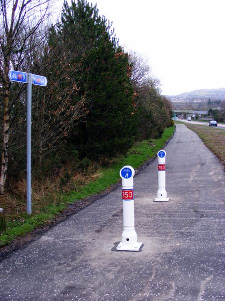
National Cycle Route at Inverkip. A short section of Route 753 by the A78 at Kip Marina was constructed in March 2011. It will eventually connect to the route at Lunderston Bay by means of an improved path along the shore at Ardgowan Estate. The marina is on the left, behind the bushes.
National Cycle Route at Inverkip. A short section of Route 753 by the A78 at Kip Marina was constructed in March 2011. It will eventually connect to the route at Lunderston Bay by means of an improved path along the shore at Ardgowan Estate. The marina is on the left, behind the bushes.
File usage
There are no pages that use this file.
Metadata
This file contains additional information, probably added from the digital camera or scanner used to create or digitise it.
If the file has been modified from its original state, some details may not fully reflect the modified file.
