File:New Cross- The New Cross House - Geograph - 1683265.jpg

From Roader's Digest: The SABRE Wiki
Jump to navigation Jump to search

New_Cross-_The_New_Cross_House_-_Geograph_-_1683265.jpg(640 × 509 pixels, file size: 95 KB, MIME type: image/jpeg)

Y topleft.gifY topright.gif
Description:
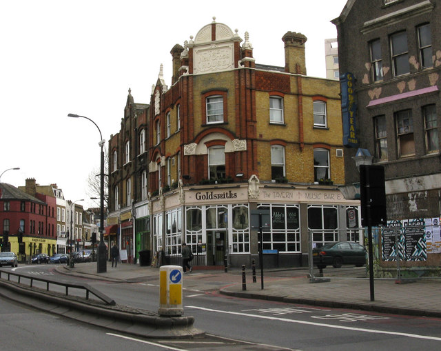
New Cross- The New Cross House
The lettering high on the corner of this building is no longer picked out so as to be easily visible, but reads 'The New Cross House', which suggests that it may have been a public house. Perhaps a site-visitor with local knowledge could throw some light on this.
Location:51.475525, -0.037358
Road:A2, A20
Date:28 01 2010
Photographer:� Copyright Dr Neil Clifton and licensed for reuse under this Creative Commons Licence
Source:Geograph

Map

Y btmleft.gifY btmright.gif

Galleries  | A2 | A20 | London | New Cross (South London)

File history

Click on a date/time to view the file as it appeared at that time.

Date/TimeThumbnailDimensionsUserComment
current10:19, 8 July 2010Thumbnail for version as of 10:19, 8 July 2010640 × 509 (95 KB)Abeaton (talk | contribs)'''New Cross- The New Cross House'''<br/>The lettering high on the corner of this building is no longer picked out so as to be easily visible, but reads 'The New Cross House', which suggests that it may have been a public house. Perhaps a site-visitor wi

Metadata

SABRE - The Society for All British and Irish Road Enthusiasts
Discuss - Digest - Discover - Help