File:New River Arms - Geograph - 1125672.jpg
Jump to navigation
Jump to search

No higher resolution available.
New_River_Arms_-_Geograph_-_1125672.jpg (640 × 480 pixels, file size: 62 KB, MIME type: image/jpeg)
| |||||||||||||||||||||||||
|
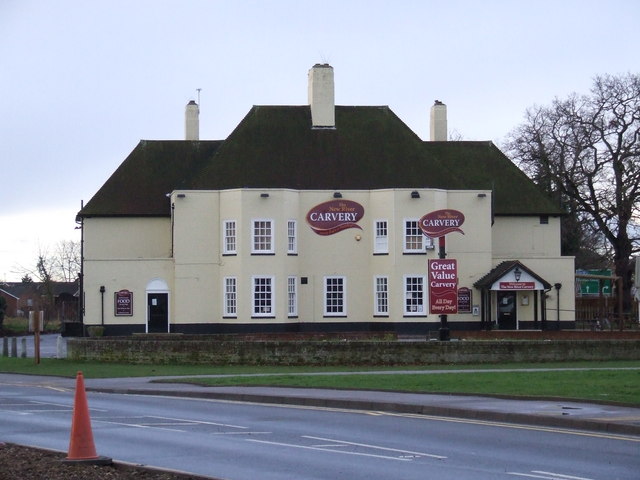
Galleries | A1170 | New River Arms Roundabout | Hertfordshire | ||
File history
Click on a date/time to view the file as it appeared at that time.
| Date/Time | Thumbnail | Dimensions | User | Comment | |
|---|---|---|---|---|---|
| current | 06:28, 27 August 2016 | | 640 × 480 (62 KB) | C2r (talk | contribs) | '''New River Arms''' The New River Arms, High Road Turnford and following what was reported as a ??300k refurbishment about 2 years ago is also now known as the New River Carvery. Strangely it closed about 6 months ago. |
File usage
The following 3 pages use this file: