
No higher resolution available.
File history
Click on a date/time to view the file as it appeared at that time.
| Date/Time | Thumbnail | Dimensions | User | Comment |
|---|
| current | 20:58, 11 April 2021 | 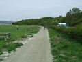 | 640 × 480 (87 KB) | Tam nugent (talk | contribs) | National Cycle Network Route 753 from NCN Route 75 has recently been extended into the picnic area at Lunderston Bay. |
File usage
There are no pages that use this file.
This file contains additional information, probably added from the digital camera or scanner used to create or digitise it.
If the file has been modified from its original state, some details may not fully reflect the modified file.
