File:Newhaven Swing Bridge - Geograph - 592762.jpg

From Roader's Digest: The SABRE Wiki
Jump to navigation Jump to search

Newhaven_Swing_Bridge_-_Geograph_-_592762.jpg(640 × 499 pixels, file size: 99 KB, MIME type: image/jpeg)

Y topleft.gifY topright.gif
Description:
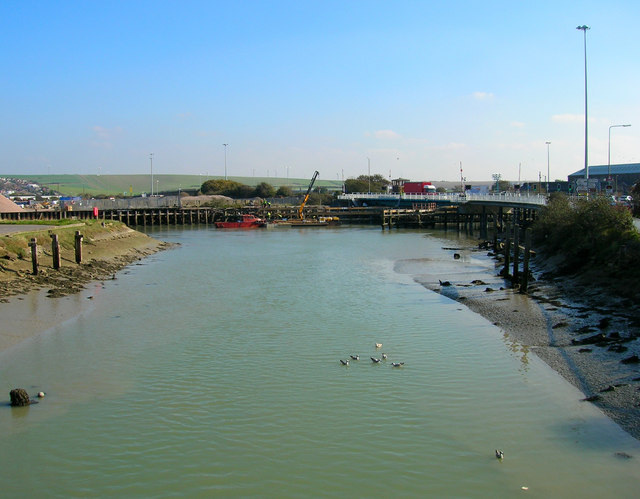
Newhaven Swing Bridge
Viewed from the bridge to Denton Island. The only major crossing point south of Lewes and the cause of many a long traffic tailback when opened. The original, manually operated, swing bridge was to the south and was replaced by this one in the mid 1970s.
Location:50.795189, 0.051782
Road:A259
Date:23 10 2007
Photographer:� Copyright Simon Carey and licensed for reuse under this Creative Commons Licence
Source:Geograph

Map

Y btmleft.gifY btmright.gif

Galleries  | A259 | Newhaven Swing Bridge | Newhaven

File history

Click on a date/time to view the file as it appeared at that time.

Date/TimeThumbnailDimensionsUserComment
current16:24, 19 May 2010Thumbnail for version as of 16:24, 19 May 2010640 × 499 (99 KB)Bob@romiley1 (talk | contribs)'''Newhaven Swing Bridge'''<br/>Viewed from the bridge to Denton Island. The only major crossing point south of Lewes and the cause of many a long traffic tailback when opened. The original, manually operated, swing bridge was to the south and was replace

The following 2 pages use this file:

Metadata

SABRE - The Society for All British and Irish Road Enthusiasts
Discuss - Digest - Discover - Help